Satellite Remote Sensing & ML Temperature Modeling
Urban Heat Island Assessment
Microclimate thermal prediction system analyzing 10 years of Landsat satellite imagery over Mumbai, achieving an RMSE of 1.07°C.
1.07°C model RMSE
10 years of satellite data
Mumbai microclimate map
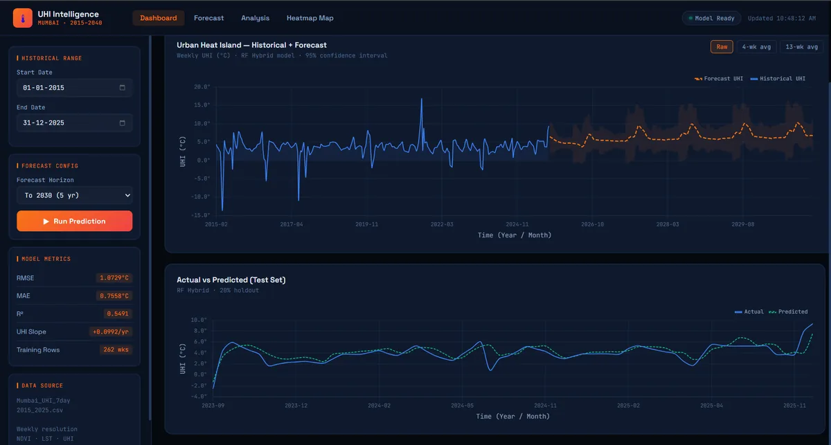
Architecture & System Implementation
Applied machine learning and Earth observation data to analyze the Urban Heat Island (UHI) effect in Mumbai. Extracted 10 years of Landsat multispectral imagery via Google Earth Engine to compute Land Surface Temperature (LST), Normalized Difference Vegetation Index (NDVI), and built-up indices. Trained Random Forest regression models to predict localized temperature anomalies from environmental and urban density features.
Core Features & Capabilities
- Decade-long satellite data ingestion spanning 10 years of Landsat-8 and Landsat-9 imagery
- Computation of critical remote sensing indices: LST, NDVI, NDBI, and thermal radiation
- Trained Random Forest and regression models achieving a tight RMSE of 1.07°C
- Spatial heat island anomaly mapping identifying high-risk urban thermal corridors
- Data preprocessing pipeline built with Pandas, NumPy, and Earth Engine APIs
Engineering Contributions & Optimizations
- Formulated cloud-masking and radiometric calibration routines in Earth Engine
- Engineered feature sets combining vegetation health, water proximity, and land cover
- Evaluated model generalization across pre-monsoon and post-monsoon seasonal cycles
Technologies & Libraries
PythonGoogle Earth EngineLandsat 8/9Scikit-LearnRandom ForestPandas
REST API Endpoint
200 OKThis project is programmatically queryable via our public JSON API:
curl -s https://rajatsurana.vercel.app/api/projects/uhi-analysis